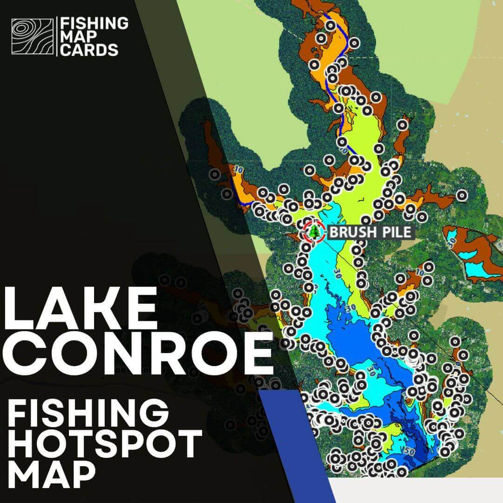

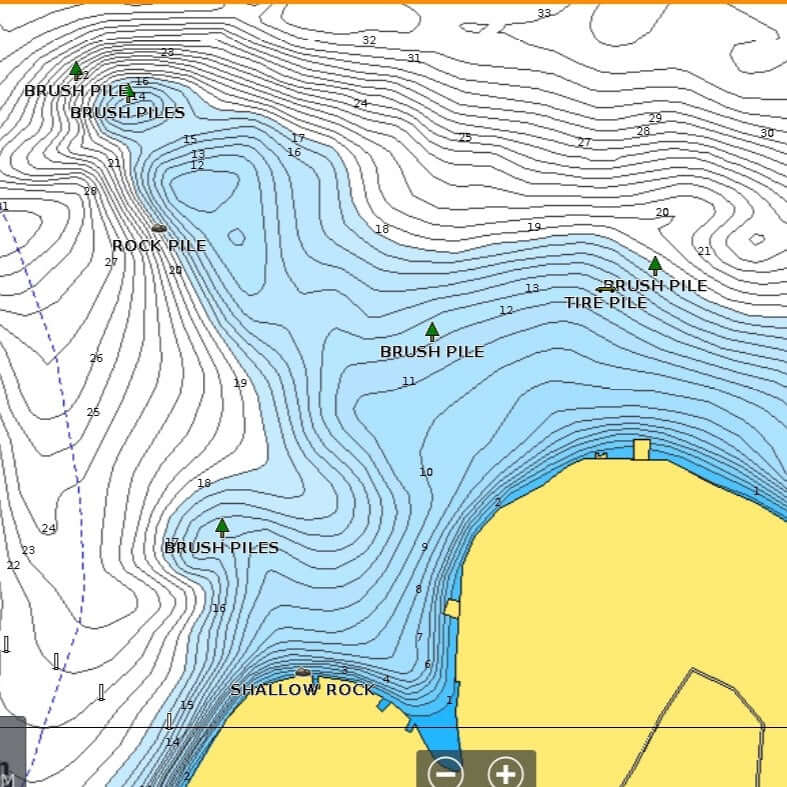


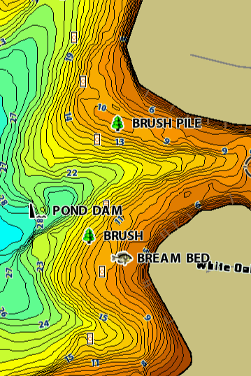
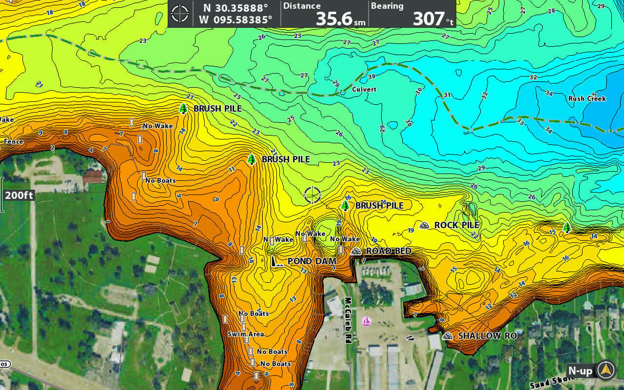
Get years of fishing guide experience in a few clicks! This SD card will plug into your fishfinder to upload FISHING HOTSPOTS known to hold fish in different areas of the lake, the rest is up to you! The GPS waypoints will show on your chart the EXACT locations of brush piles, rock piles, ledges, bream beds, road beds, and tire piles. Take the guess work out of where to fish on Lake Conroe.
Silver - 125 waypoints
Gold - 250 waypoints, 5% off
Platinum - 375 waypoints, 10% off
For online downloads, have an SD card ready to go. Upon checkout you will be sent the files for download! Learn more about how to upload.
This product is not intended for navigational purposes. This product only serves as a display of fishing hotspots.
How it works
Our expertly selected waypoints, chosen by professional guides, are clearly marked with icons and names, ensuring you target the most productive fishing spots with precision.
an investment
Guide trips only teach you what’s working on that specific day at those specific spots. This hotspot card costs less, works whenever you fish, and gives you a massive advantage every time you're on the water.


Map was very detailed and helped us have a fun weekend on a new body of water.
My husband and I purchased both Sam Rayburn & Toledo Bend maps! We spent July 4th weekend on both lakes. Every brush pile marked on the map is exactly where it says it is! You will not be disappointed in your purchase!
I really found the maps when I installed it. It was easy to download in. The maps were really knowledgeable.
Hugh checked with me on my order to confirm I was getting what I needed and also made sure I was able to correctly download the the data.
First trip out to the lake with the coordinates gave me a limit of fish!
Worth every penny!
Just bought and downloaded for the local lake. Used it Saturday to find some brush piles and can’t wait to get it all figured out!
Great map. Has everything you need, to learn the lake. Worth the price.
This card is amazing it shows you a lot of spots to fish on lake limestone
This download for my GARMIN unit was amazing. The waypoints out us on fish right form the start. Installation was super simple and service was great. Couldn’t be more satisfied. Thanks.
Caught fish and one was 5 LB bass, on my first trip with map card. Some good spots marked in map card.
Just uploaded the Limestone Spots and Lanes Card
Went to a brush pile marked and caught a 7 pounder. The timber line is marked perfectly. 100% recommend this if you have never been to Limestone before!!!
Easy to download. I was able to go to Bois dArc and find fish my first trip. Saved me a ton of time searching. Well worth the money!
I purchased the complete maps and way points for my husbands birthday! What an incredible gift - it keeps on giving - every single time he’s on the lake!
Lake Fork hotspots are great! Very detailed and easy to download and transfer to my Hummingbird Explore 12
Specializes in detailed fishing map cards with accurate waypoints for lakes. Easy download and installation. Exceptional customer service with prompt support. Maps save time by marking brush piles, boat lanes, and fishing hotspots precisely. Customers consiste...
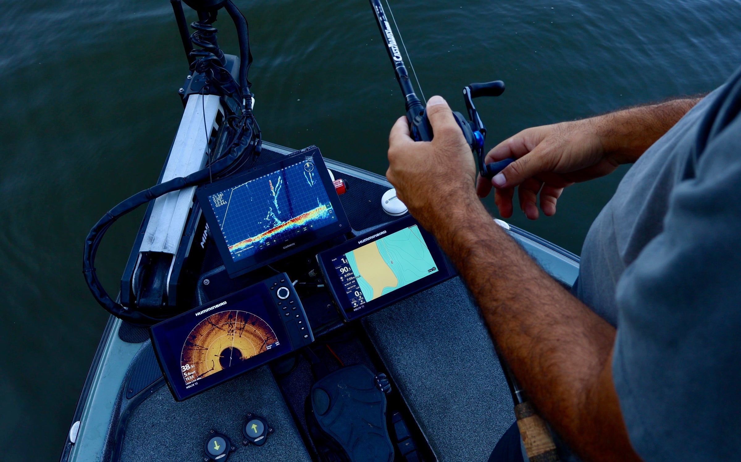
These are removable micro SD cards and SD card adapters that contain fishing hotspots. Each fishfinder comes with micro SD or full size SD card slot to install waypoints, retrieve screenshots, update software, or install upgraded contour maps.
These SD cards are mainly filled with fishing hotspots and creek channels to help you narrow down where the fish are quicker to help you run a pattern of how to catch fish all over the lake.
These are designed to give the newer anglers, weekend warriors, or traveling tournament fisherman the best odds at doing well when they can't spend all of their time idling around and looking for structure. Take the hard work of guides to be able to narrow down where high percentage spots and populations of fish are to make your days on the water more enjoyable.
Definitely! If you purchase a silver or gold level SD card and want to upgrade it, send us an email with your name, order number, or contact email at sales@fishingmapcards.com. Let us know which product you'd like to upgrade to and we can send a new invoice for the cost of the difference!
We travel to these lakes and put the time in to idle the lake and graph high percentage spots. Using guide and professional tournament knowledge along with time on the body of water, these fishing hotspot maps are created where we actually fish on the water.
The creek channel maps are created using aerial imagery to trace creek channels and find pond dams and then are confirmed on the water.
This is entirely up to you. For online downloads, an email is sent to you immediately upon checkout containing the files you need to upload. If you have experience downloading waypoints this is an easy process. If you have trouble downloading or installing, check out out How to Upload.
If you are unsure of how to download these products or don't have a micro SD or full size SD card available, we suggest getting a physical card. We install each product on to our own fishfinders before we send them to you to confirm the SD cards and products are up to standard.
Yes! We have it automatically apply a 75% discount to your 2nd or 3rd fishfinder brand.
If you have already made one purchase and want to make another please email us at sales@fishingmapcards.com.
Yes! You get one card. A discount is automatically applied during checkout.
Please add all products in the form of physical SD cards. Your cart will automatically update to decrease the price to reflect only one SD card being sent. If not otherwise noted, all files will be combined into one for Humminbird files.
For Lowrance -
We recommend micro SD/SD cards between 2-32gb. For more information on your specific unit, check out SD card sizing for Lowrance.
For Humminbird -
We recommend any microSD/SD card up to 32gb as recommended by Humminbird.
For Garmin -
As recommended by Garmin, any card up to 32gb between class 4 and class 10 will work with their chart plotters.
We send 8 GB micro SD cards with SD card adapters.
Lowrance files are .gpx files. Some units like the Elites may require .usr files.
Humminbird files are .ht and .hwr files.
Garmin files are .gpx files.
Garmin uses a different format for their tracks and trails that does not work with our software. Tracks like creek channels that we mark are a combination of 100's of smaller tracks combined into one. Garmin won't show these trails correctly which reflects some products having a less expensive cost for Garmin products or not even having Garmin as an option.
Contact us